Introduction
LiDAR (Light Detection and Ranging) technology has emerged as a game-changer in the field of surveying, particularly when integrated with drones. This article explores the transformative impact of LiDAR technology on drone-based surveying, highlighting its precision, efficiency, and the various applications where it excels.
How LiDAR Enhances Drone Surveying
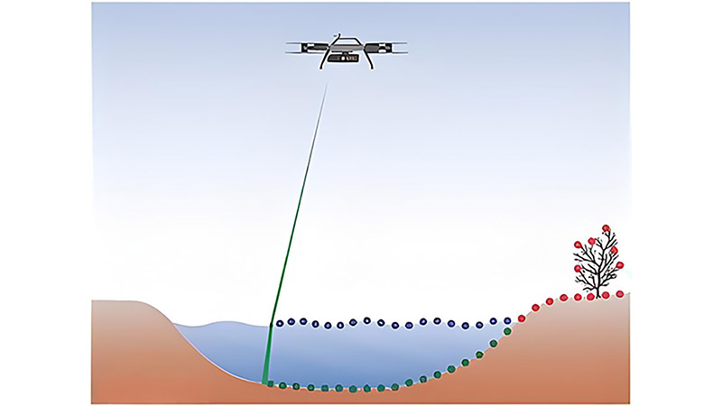
LiDAR enhances drone surveying by providing highly accurate distance measurements through the emission and reflection of laser pulses. These measurements allow for the creation of detailed 3D models of the surveyed area, which are critical for accurate mapping and analysis. The technology’s ability to penetrate obstacles, such as vegetation, and capture data in low-light conditions further boosts its utility in complex environments.
Applications in Various Industries
LiDAR-equipped drones are used across multiple industries, including construction, agriculture, forestry, and urban planning. In construction, they are employed to create precise topographical maps, ensuring accurate site planning and reducing the risk of costly errors. In agriculture, LiDAR drones help in monitoring crop health and managing resources efficiently. The ability to capture detailed data over large areas quickly makes LiDAR drones invaluable in these sectors.
Advantages Over Traditional Surveying Methods
Compared to traditional surveying methods, LiDAR drones offer significant advantages in terms of speed, accuracy, and safety. They can cover large areas in a fraction of the time required by ground-based methods and with minimal human intervention. This not only reduces costs but also minimizes the risks associated with manual data collection in hazardous environments.
Case Study: Urban Planning with LiDAR Drones
A recent urban planning project utilized LiDAR-equipped drones to map a rapidly developing city area. The drones provided high-resolution 3D models, enabling planners to identify optimal building sites, assess infrastructure needs, and monitor ongoing construction activities. The project demonstrated the efficiency and accuracy of LiDAR technology in supporting sustainable urban development.
Conclusion
LiDAR technology has significantly enhanced the capabilities of drone-based surveying, making it an indispensable tool in various industries. Its precision, efficiency, and ability to operate in challenging environments offer clear advantages over traditional methods. As technology continues to advance, the role of LiDAR in drone surveying is expected to expand, offering even more innovative solutions to complex surveying challenges.


