LiDAR (Light Detection and Ranging) technology has made a significant impact on the energy sector by improving the efficiency and safety of power generation and infrastructure management. From wind farm site selection to transmission line monitoring, LiDAR provides accurate data that helps optimize operations, reduce costs, and enhance performance. This article explores how LiDAR is transforming the energy sector and the benefits it brings to various energy applications.
Wind Farm Site Selection and Design
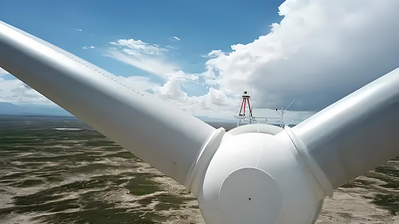
One of the key applications of LiDAR in the energy sector is in the selection and design of wind farms. LiDAR technology is used to measure wind speed and direction at various heights, providing valuable data for assessing the suitability of potential sites for wind turbines. By analyzing wind patterns and atmospheric conditions, LiDAR helps identify the most favorable locations for wind energy generation.
LiDAR data also supports the design of wind farm layouts by mapping the topography and identifying potential obstacles. Accurate terrain models generated from LiDAR scans enable engineers to optimize turbine placement, maximize energy production, and minimize the impact on the environment and surrounding communities.
Power Line Inspection and Maintenance
Maintaining and inspecting power lines is a critical aspect of energy infrastructure management. Traditional methods of inspecting power lines can be time-consuming and hazardous, but LiDAR offers a safer and more efficient alternative. By using aerial LiDAR systems mounted on helicopters or drones, utility companies can capture detailed 3D data of power lines and surrounding infrastructure.
LiDAR data helps identify issues such as vegetation encroachment, structural damage, or conductor sag, allowing maintenance teams to prioritize repairs and prevent power outages. Regular LiDAR inspections also help in planning upgrades or replacements of aging infrastructure, ensuring reliable and efficient power delivery.
Pipeline Monitoring and Management
In the energy sector, LiDAR is used for monitoring and managing pipelines, which are crucial for transporting oil, gas, and other resources. LiDAR provides detailed topographic data that helps in assessing the condition of pipelines, detecting potential leaks, and planning maintenance activities.
For example, LiDAR can be used to monitor changes in the terrain around pipelines, such as erosion or ground movement, which may affect pipeline integrity. This information allows operators to take preventive measures and ensure the safety and reliability of pipeline operations.
Solar Power Site Assessment
LiDAR is also valuable for assessing potential sites for solar power installations. By providing accurate topographic and vegetation data, LiDAR helps in evaluating the suitability of locations for solar panels. Detailed terrain models generated from LiDAR scans enable engineers to identify areas with optimal sunlight exposure and minimize shading from surrounding structures or vegetation.
Additionally, LiDAR data supports the design of solar farm layouts, allowing for efficient placement of solar panels and maximizing energy capture. This helps in optimizing the performance of solar power systems and reducing the overall cost of installation.
Environmental Impact Assessment
The energy sector often involves large-scale projects that can have significant environmental impacts. LiDAR technology is used to assess and monitor these impacts by providing detailed data on land use, vegetation, and environmental conditions.
For example, LiDAR can be used to evaluate the impact of energy infrastructure on wildlife habitats, wetlands, and other sensitive areas. This information helps in developing mitigation strategies to minimize environmental disruption and ensure compliance with regulatory requirements.
Enhancing Safety and Risk Management
Safety is a top priority in the energy sector, and LiDAR contributes significantly to risk management. By providing detailed 3D models of energy infrastructure, LiDAR helps identify potential hazards and assess risks associated with construction, operation, and maintenance activities.
For example, LiDAR data can be used to evaluate the stability of structures such as wind turbine towers or transmission towers, ensuring that they are built to withstand environmental conditions and operational stresses. Additionally, LiDAR can assist in planning safe access routes and emergency response strategies.
Future Trends and Innovations
The future of LiDAR in the energy sector is promising, with ongoing advancements driving new applications and improvements. Innovations include the development of more compact and affordable LiDAR sensors, integration with other technologies such as machine learning and artificial intelligence, and the use of real-time data analytics.
For example, the integration of LiDAR with drones and autonomous vehicles will enhance the ability to capture data from remote or hazardous locations, improving efficiency and safety. Real-time LiDAR data analytics will also enable more dynamic and responsive management of energy infrastructure, leading to better performance and reduced operational costs.
Conclusion
LiDAR technology has revolutionized the energy sector by providing accurate, high-resolution data that enhances power generation, infrastructure management, and environmental assessment. From optimizing wind and solar power installations to improving pipeline monitoring and power line inspections, LiDAR offers significant benefits for efficiency, safety, and cost management. As technology continues to advance, LiDAR will play an increasingly important role in shaping the future of the energy sector and driving sustainable energy solutions.


