LiDAR (Light Detection and Ranging) technology has become a vital tool in forestry management, offering detailed insights that improve forest conservation, resource management, and research. By providing high-resolution, 3D data of forested areas, LiDAR helps forestry professionals make informed decisions about forest health, biodiversity, and sustainable management practices. This article explores how LiDAR is enhancing forestry management and the benefits it brings to forest conservation and resource management.
Detailed Forest Mapping and Inventory
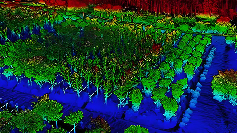
One of the primary applications of LiDAR in forestry is creating detailed maps and inventories of forested areas. Traditional methods of forest inventory can be labor-intensive and prone to inaccuracies, but LiDAR provides precise and comprehensive data on tree height, canopy cover, and forest structure.
LiDAR technology captures the three-dimensional structure of forests, including the height and density of trees, which is crucial for estimating timber volume and biomass. This data helps forest managers develop accurate inventories and assess the value of timber resources, leading to better planning and decision-making.
Monitoring Forest Health and Changes
LiDAR is essential for monitoring forest health and detecting changes in forest conditions over time. By comparing LiDAR scans from different time periods, forestry professionals can track changes in tree cover, detect signs of disease or pest infestations, and identify areas affected by natural disturbances such as wildfires or storms.
For example, LiDAR data can reveal changes in forest canopy density, which may indicate issues such as defoliation or tree mortality. Early detection of these changes allows for timely interventions and management actions to address emerging problems and protect forest ecosystems.
Assessing Habitat and Biodiversity
Forests are rich ecosystems that support a diverse range of plant and animal species. LiDAR provides valuable information for assessing forest habitats and understanding the spatial distribution of biodiversity. By mapping forest structure and canopy layers, LiDAR helps identify critical habitats for wildlife and assess the impact of forest management practices on biodiversity.
For instance, LiDAR data can be used to analyze the availability of different types of forest cover, such as dense canopy layers or open understories, which are important for various species. This information helps in developing conservation strategies that support habitat preservation and species protection.
Supporting Sustainable Forest Management
Sustainable forest management requires a balance between resource extraction and conservation. LiDAR technology supports sustainable practices by providing accurate data on forest conditions and enabling informed decision-making.
For example, LiDAR can be used to plan logging operations by mapping areas for selective harvesting and avoiding sensitive habitats. By creating detailed models of forested areas, LiDAR helps ensure that timber extraction is done in a way that minimizes environmental impact and promotes forest regeneration.
Additionally, LiDAR data can assist in developing reforestation and afforestation plans by identifying suitable areas for planting and assessing the success of planting efforts. This contributes to the overall sustainability of forest management practices.
Enhancing Fire Management and Prevention
Wildfires are a significant threat to forests, and LiDAR technology plays a crucial role in fire management and prevention. LiDAR data provides detailed information on forest structure, fuel loads, and terrain, which is essential for assessing fire risk and planning fire management strategies.
For example, LiDAR can be used to map areas with high fuel loads, such as dense undergrowth or fallen trees, which are more susceptible to fire. This information helps in planning controlled burns, creating firebreaks, and managing vegetation to reduce the risk of catastrophic wildfires.
LiDAR data can also assist in post-fire assessments by mapping burned areas and evaluating the extent of damage. This information is valuable for recovery efforts and understanding the impact of wildfires on forest ecosystems.
Improving Research and Policy Development
LiDAR contributes to forestry research by providing accurate and detailed data for scientific studies. Researchers use LiDAR to investigate forest dynamics, study tree growth patterns, and analyze the impact of environmental changes on forests. This research informs the development of policies and practices that promote forest conservation and sustainable management.
For example, LiDAR data is used in climate change research to assess how forests are responding to changing temperatures and precipitation patterns. This information helps policymakers develop strategies to mitigate the effects of climate change and protect forest ecosystems.
Future Trends and Innovations
The future of LiDAR in forestry management is promising, with ongoing advancements driving new applications and improvements. Innovations include the development of more advanced LiDAR sensors, integration with other technologies such as drones and remote sensing, and advancements in data processing and analysis.
For example, the use of drone-based LiDAR systems allows for more flexible and cost-effective data collection, especially in remote or difficult-to-access areas. Integration with remote sensing technologies and machine learning algorithms will enhance the ability to analyze and interpret LiDAR data, providing even more insights into forest conditions and management.
Conclusion
LiDAR technology has revolutionized forestry management by providing detailed, high-resolution data that enhances forest conservation, resource management, and research. From mapping forest structure and monitoring health to supporting sustainable practices and improving fire management, LiDAR offers significant benefits for managing and preserving forest ecosystems. As technology continues to advance, LiDAR will play an increasingly important role in ensuring the sustainability and health of our forests.


