LiDAR (Light Detection and Ranging) technology has become a vital tool in forestry, offering precise, three-dimensional data that enhances forest management, conservation, and research. By providing detailed information on forest structure, biomass, and canopy cover, LiDAR supports more effective management practices, improves conservation efforts, and aids in understanding forest dynamics. This article explores how LiDAR is revolutionizing forestry and the benefits it brings to the field.
Mapping Forest Structure and Canopy Cover
One of the primary applications of LiDAR in forestry is mapping forest structure and canopy cover. Traditional methods of forest measurement can be time-consuming and limited by the density of the vegetation, but LiDAR provides a more efficient and detailed approach.
LiDAR technology captures high-resolution data on the vertical structure of forests, including canopy height, tree density, and ground elevation. This data is used to create detailed 3D models of forests, which help foresters understand the spatial arrangement of trees and assess canopy cover. For example, LiDAR can provide accurate measurements of canopy height and tree spacing, which are essential for evaluating forest health and planning management activities.
Assessing Forest Biomass and Carbon Stocks
LiDAR technology plays a crucial role in assessing forest biomass and carbon stocks, which are important for understanding forest productivity and contributing to climate change mitigation efforts.
LiDAR data allows for accurate estimation of forest biomass by measuring tree height and canopy structure. This information is used to calculate the amount of carbon stored in forest ecosystems, which is critical for carbon accounting and reporting. For example, LiDAR can be used to estimate the biomass of tropical rainforests, which store significant amounts of carbon and play a key role in global climate regulation.
Monitoring Forest Health and Dynamics
Monitoring forest health and dynamics is essential for managing forest ecosystems and addressing threats such as pests, diseases, and environmental changes. LiDAR technology supports this by providing detailed and accurate data on forest conditions.
LiDAR can be used to detect changes in forest structure, such as shifts in canopy cover or tree mortality. This information helps foresters identify areas affected by diseases, pests, or environmental stressors and implement targeted management actions. For example, LiDAR data can reveal patterns of tree dieback or canopy thinning, which can be linked to factors such as drought or invasive species.
Supporting Sustainable Forest Management
Sustainable forest management aims to balance environmental, social, and economic objectives in forest use and conservation. LiDAR technology supports sustainable practices by providing data that informs management decisions and improves planning.
LiDAR can be used to assess forest resources, plan logging activities, and monitor the impact of management practices. For example, LiDAR data helps in creating detailed maps of timber resources, planning harvests to minimize environmental impact, and monitoring the effectiveness of reforestation efforts. By providing accurate and up-to-date information, LiDAR supports more sustainable and efficient forest management practices.
Enhancing Fire Risk Assessment and Management
Forest fires pose a significant risk to forest ecosystems, and LiDAR technology supports fire risk assessment and management by providing detailed data on forest structure and fuel loads.
LiDAR data can be used to map fuel loads, assess vegetation density, and identify areas at high risk of fire. This information helps in planning fire prevention measures, designing controlled burns, and managing fire response efforts. For example, LiDAR surveys can be used to create fire risk maps that guide the placement of firebreaks and other protective measures.
Aiding in Habitat Conservation and Biodiversity
Forests provide critical habitats for a wide range of species, and LiDAR technology supports habitat conservation and biodiversity efforts by providing detailed information on forest structure and habitat features.
LiDAR can be used to map and monitor important habitat features, such as tree canopy cover, forest gaps, and understory vegetation. This information helps conservationists identify and protect key habitats for wildlife, assess the impact of land use changes, and support biodiversity conservation initiatives. For example, LiDAR data can be used to assess the quality of habitat for species such as birds or mammals, guiding conservation efforts to protect their habitats.
Future Trends and Innovations
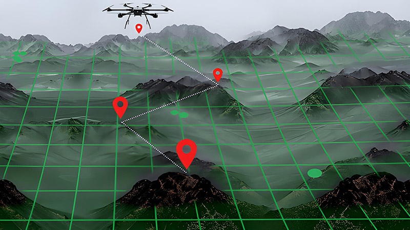
The future of LiDAR in forestry is promising, with ongoing advancements driving new applications and capabilities. Innovations include the development of more advanced LiDAR sensors, integration with other remote sensing technologies, and improvements in data processing and analysis.
For example, the use of drone-based LiDAR systems allows for more flexible and cost-effective data collection in forests. Advances in machine learning and data analytics will enhance the ability to interpret LiDAR data, providing deeper insights into forest dynamics and supporting more effective management and conservation practices.
Conclusion
LiDAR technology has transformed forestry by providing detailed, high-resolution data that enhances forest management, conservation, and research. From mapping forest structure and assessing biomass to monitoring forest health and supporting sustainable practices, LiDAR offers significant benefits for modern forestry. As technology continues to evolve, LiDAR will play an increasingly important role in advancing forest management and conservation efforts, ensuring the health and sustainability of forest ecosystems.


