LiDAR (Light Detection and Ranging) technology plays a crucial role in disaster management by providing detailed, high-resolution data that enhances response and recovery efforts. Whether dealing with natural disasters such as floods, earthquakes, or wildfires, or managing the aftermath of human-made incidents, LiDAR offers valuable insights that support decision-making and improve the effectiveness of disaster management strategies. This article explores how LiDAR is used in disaster management and the benefits it brings to enhancing response and recovery efforts.

Mapping and Assessing Disaster Impact
One of the primary applications of LiDAR in disaster management is mapping and assessing the impact of disasters. LiDAR technology provides detailed, three-dimensional data that helps emergency responders and planners understand the extent of damage and prioritize response efforts.
For example, after a flood, LiDAR can be used to map the extent of inundation, identify areas of severe damage, and assess changes in land elevation. This information is crucial for determining the areas most in need of immediate assistance, planning evacuation routes, and allocating resources effectively. Similarly, after an earthquake, LiDAR data can help identify damaged buildings, assess ground deformation, and plan for structural assessments and repairs.
Supporting Emergency Response Operations
LiDAR technology supports emergency response operations by providing accurate and up-to-date information about affected areas. High-resolution LiDAR maps enable emergency responders to navigate disaster zones, identify hazards, and plan response strategies.
For example, LiDAR data can be used to create detailed maps of damaged infrastructure, such as roads, bridges, and utilities. This information helps responders plan safe routes for rescue operations, assess the condition of critical infrastructure, and coordinate repair efforts. Additionally, LiDAR can help identify obstacles and hazards in the environment, such as debris or unstable terrain, ensuring that response teams can operate safely and efficiently.
Enhancing Flood Risk Management
Flooding is a common and devastating natural disaster, and LiDAR technology plays a key role in flood risk management. LiDAR data provides detailed information on topography, land elevation, and drainage patterns, which is essential for assessing flood risk and planning flood management strategies.
For example, LiDAR can be used to create floodplain maps that show areas at risk of flooding and help plan flood defenses such as levees and floodwalls. By analyzing LiDAR data, planners can identify areas prone to flooding, design effective drainage systems, and implement measures to reduce flood risk. LiDAR also supports the monitoring of flood events, providing real-time data that helps manage and respond to ongoing floods.
Assisting in Wildfire Management
Wildfires pose a significant threat to both natural and urban environments, and LiDAR technology supports wildfire management by providing detailed data on vegetation, terrain, and fire behavior.
LiDAR can be used to map vegetation cover, assess fuel loads, and identify areas at high risk of wildfires. This information helps in planning controlled burns, creating firebreaks, and managing vegetation to reduce fire risk. During a wildfire, LiDAR data can assist in tracking the fire’s progression, assessing damage, and planning evacuation routes.
Aiding in Post-Disaster Recovery and Reconstruction
The recovery and reconstruction phases after a disaster are critical for restoring communities and infrastructure. LiDAR technology supports these efforts by providing accurate data on damage assessment, infrastructure condition, and rebuilding needs.
For example, LiDAR data can be used to assess the extent of structural damage, evaluate the condition of roads and bridges, and plan for rebuilding efforts. Detailed 3D models of affected areas help planners design reconstruction projects, prioritize repairs, and allocate resources effectively. LiDAR also supports the monitoring of recovery progress, providing updated data on the state of infrastructure and facilities.
Improving Disaster Preparedness and Planning
LiDAR technology contributes to disaster preparedness and planning by providing detailed data that supports risk assessment and mitigation strategies. By analyzing LiDAR data, planners can identify vulnerabilities, assess the potential impact of different disaster scenarios, and develop strategies to reduce risk.
For example, LiDAR data can be used to create hazard maps that show areas at risk of natural disasters such as landslides or tsunamis. This information helps in developing emergency response plans, designing evacuation routes, and implementing mitigation measures to protect communities and infrastructure.
Future Trends and Innovations
The future of LiDAR in disaster management is promising, with ongoing advancements driving new applications and capabilities. Innovations include the development of more advanced and cost-effective LiDAR sensors, integration with other remote sensing technologies, and improvements in data processing and analysis.
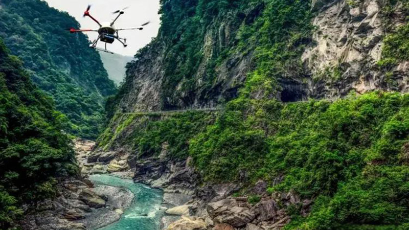
For example, the integration of LiDAR with drone technology allows for rapid and flexible data collection in disaster zones. Advances in real-time data processing and machine learning algorithms will enhance the ability to analyze LiDAR data and provide timely insights for disaster management.
Conclusion
LiDAR technology plays a vital role in disaster management by providing detailed, high-resolution data that enhances response and recovery efforts. From mapping and assessing disaster impact to supporting emergency operations and improving preparedness, LiDAR offers significant benefits for managing and mitigating the effects of disasters. As technology continues to evolve, LiDAR will play an increasingly important role in enhancing disaster management strategies and improving resilience in the face of natural and human-made disasters.


