Introduction
Terrain mapping is a critical component of various industries, from construction to environmental management. Traditional terrain mapping methods, while effective, are often labor-intensive and time-consuming. This article explores how LiDAR-equipped drones have transformed terrain mapping by providing a more efficient and accurate solution.
Applications of LiDAR in Terrain Mapping
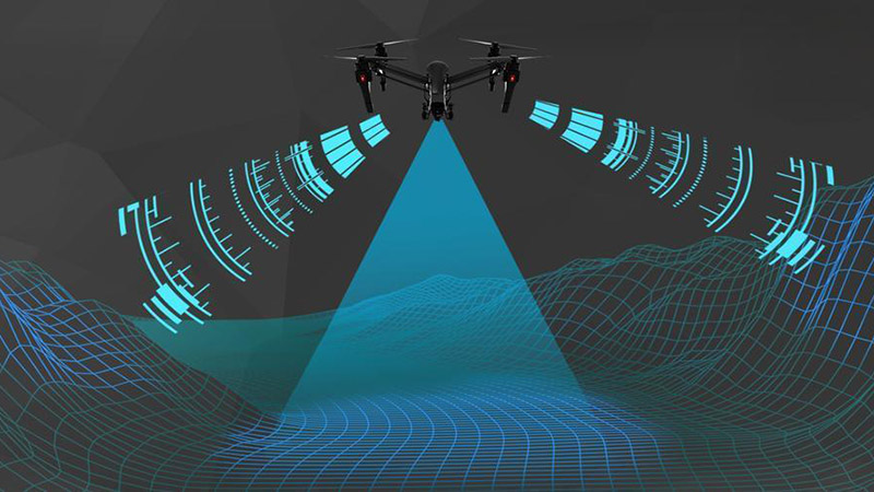
LiDAR drones are particularly effective in mapping complex terrains, such as mountainous regions, forests, and urban environments. By flying at low altitudes and using laser pulses to penetrate obstacles like vegetation, LiDAR drones can create detailed topographical maps that are invaluable for planning and analysis.
Data Collection and Processing
The process of collecting and processing LiDAR data involves several steps. First, the drone flies over the target area, capturing millions of laser pulses that reflect off the terrain. These reflections are then processed to create a detailed 3D point cloud, which can be further analyzed to produce contour maps, elevation models, and other useful outputs.
Accuracy and Resolution
LiDAR technology offers unmatched accuracy and resolution, making it ideal for terrain mapping. The high density of data points captured by LiDAR allows for the detection of even minor variations in elevation, providing a level of detail that is difficult to achieve with other methods.
Case Study
In a recent terrain mapping project, a LiDAR drone was used to survey a hilly region with dense vegetation. The drone’s ability to penetrate the tree canopy and capture detailed ground data allowed for the creation of an accurate digital elevation model (DEM). This data was then used to guide a construction project, ensuring that the terrain was properly accounted for in the planning process.


