Introduction
As smart ships continue to evolve, the integration of LiDAR technology with autonomous navigation systems has become increasingly important. LiDAR provides precise, real-time data that is essential for the safe and efficient operation of autonomous ships. This article will explore how LiDAR integrates with other navigational systems, such as radar, GPS, and AI-based systems, highlighting the importance of synchronization, data fusion, and troubleshooting common integration issues.
The Role of LiDAR in Autonomous Navigation
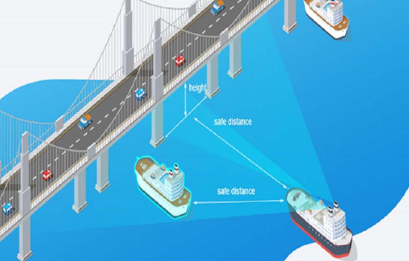
LiDAR technology plays a crucial role in the operation of autonomous ships by providing detailed information about the ship’s surroundings. This data is used to detect obstacles, map the seafloor, and assist in navigation, particularly in complex or congested environments. Unlike radar, which uses radio waves, LiDAR uses laser beams to create high-resolution, three-dimensional images of the surrounding area. This level of detail is essential for autonomous navigation systems that require precise information to make real-time decisions.
In addition to obstacle detection, LiDAR can be used to monitor the ship’s position relative to the shoreline, other vessels, and navigational markers. This information is critical for maintaining the ship’s course and avoiding collisions, particularly in areas with heavy traffic or challenging navigational conditions.
Synchronization with Other Navigational Systems
For LiDAR to be effective in autonomous navigation, it must be synchronized with other navigational systems on the ship, including radar, GPS, and the ship’s central navigation computer. Synchronization ensures that all systems are working together, providing a cohesive and accurate picture of the ship’s surroundings. This is particularly important for autonomous ships, which rely on multiple data sources to make informed decisions.
Synchronization can be achieved through the use of time-stamping, where each data point from the LiDAR system is tagged with a specific time, allowing it to be accurately correlated with data from other systems. Additionally, the ship’s navigation software must be capable of processing and integrating data from multiple sources in real-time, ensuring that the most accurate and up-to-date information is available to the ship’s autonomous systems.
Data Fusion and Integration
Data fusion is the process of combining data from multiple sources, such as LiDAR, radar, and GPS, to create a comprehensive view of the ship’s surroundings. This process is essential for autonomous navigation systems, which rely on accurate and complete data to make decisions. By fusing data from different sensors, the ship’s systems can compensate for the limitations of individual sensors and improve overall accuracy.
For example, while LiDAR provides high-resolution data, it may be affected by weather conditions such as fog or rain. Radar, on the other hand, is less affected by weather but may not provide the same level of detail as LiDAR. By combining data from both sensors, the ship’s systems can create a more accurate picture of the environment, improving navigational safety.
Data fusion requires advanced algorithms and processing capabilities, which are typically integrated into the ship’s central navigation computer. These algorithms must be capable of handling large amounts of data in real-time, ensuring that the ship’s autonomous systems have the information they need to operate safely and efficiently.
Troubleshooting Integration Issues
Integrating LiDAR with other navigational systems on smart ships can present several challenges. Common issues include data synchronization problems, sensor calibration errors, and software compatibility issues. Troubleshooting these issues requires a systematic approach, starting with the identification of the root cause of the problem.
One common issue is data synchronization, where the data from the LiDAR system is not accurately aligned with data from other sensors. This can be caused by discrepancies in time-stamping or delays in data transmission. To resolve this issue, it may be necessary to adjust the synchronization settings in the ship’s navigation software or to implement more precise time-stamping methods.
Another issue is sensor calibration errors, where the LiDAR system is not properly calibrated, leading to inaccurate data. Regular calibration and testing of the LiDAR system are essential to ensure that it provides accurate data. In some cases, it may be necessary to recalibrate the system after significant changes to the ship’s environment or operational conditions.
Finally, software compatibility issues can arise when integrating LiDAR with other navigational systems. These issues can typically be resolved by updating the ship’s navigation software or by implementing custom integration solutions that allow the different systems to communicate effectively.
Ensuring Reliable Performance
To ensure the reliable performance of LiDAR systems in autonomous navigation, it is essential to conduct regular testing and maintenance. This includes routine checks of the LiDAR sensors, calibration of the system, and testing of the data fusion algorithms. Additionally, it is important to stay updated with the latest advancements in LiDAR technology and navigation software, as these can offer improvements in accuracy, reliability, and integration capabilities.
Training for the crew is also crucial, even on autonomous ships, to ensure that they understand how the LiDAR system operates and how to troubleshoot any issues that may arise. While autonomous systems can handle many tasks independently, human oversight is still necessary to ensure that the systems are functioning correctly and to intervene in case of emergencies.
Conclusion
Integrating LiDAR with autonomous navigation systems on smart ships is essential for ensuring safe and efficient operations. By understanding the role of LiDAR, ensuring synchronization with other systems, implementing effective data fusion techniques, and troubleshooting common integration issues, ship operators can maximize the benefits of this advanced technology. Regular testing, maintenance, and crew training are also critical to ensuring the reliable performance of LiDAR systems in autonomous navigation, paving the way for the future of smart shipping.


