Shipborne LIDAR (Light Detection and Ranging) systems are essential tools for modern maritime navigation, providing precise environmental data that enhances safety and operational efficiency. Understanding how these systems work and their technical details can shed light on their importance in the maritime industry.
1. Basic Principles of Shipborne LIDAR
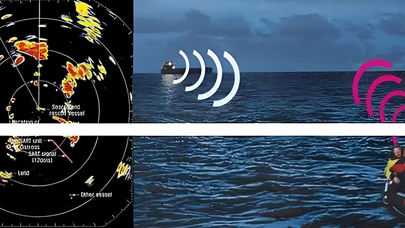
LIDAR systems on ships use laser light to measure distances to objects and map the surrounding environment. The fundamental principle involves emitting laser pulses and measuring the time it takes for the reflected light to return to the sensor. This time delay is converted into distance data, which is then used to create a detailed, three-dimensional map of the ship’s surroundings.
Key Components:
- Laser Emitter: Sends out laser pulses in rapid succession.
- Receiver/Sensor: Captures the reflected light from objects.
- Processor: Calculates distances based on the time delay and compiles data into a 3D representation.
2. Shipborne LIDAR System Components
Laser Source:
- Function: Emits laser pulses at a specific wavelength. On ships, this is typically a solid-state laser or a fiber laser.
- Technical Insight: The wavelength of the laser affects the system’s ability to penetrate water and atmospheric conditions. Shorter wavelengths generally provide higher resolution but may be more affected by weather.
Scanning Mechanism:
- Function: Rotates or moves the laser beam to cover a wide area around the ship.
- Technical Insight: Scanning mechanisms can be either mechanical (using rotating mirrors) or solid-state (using electronic scanning). Mechanical systems often offer wider coverage but may have moving parts that require maintenance.
Detection System:
- Function: Receives the reflected laser pulses and converts them into electronic signals.
- Technical Insight: The sensitivity and speed of the detector are crucial for capturing high-resolution data and handling rapid pulse emissions.
Data Processing Unit:
- Function: Analyzes the time delay of the reflected pulses and creates a detailed 3D map.
- Technical Insight: Advanced algorithms are used to filter noise, handle large data volumes, and integrate with other navigational systems. High processing power is needed for real-time applications.
3. Operational Modes of Shipborne LIDAR
Continuous Wave LIDAR:
- Function: Emits a continuous laser beam and measures the phase shift of the returned signal.
- Application: Often used for high-resolution, detailed scanning of the ship’s surroundings.
Pulsed LIDAR:
- Function: Emits short bursts of laser pulses and measures the time between emission and return.
- Application: Suitable for long-range measurements and detecting distant objects.
4. Applications of Shipborne LIDAR
Navigation and Collision Avoidance:
- Function: Provides real-time data on obstacles and navigational hazards, allowing for safer course adjustments.
- Benefit: Reduces the risk of collisions by providing detailed, accurate information about the surrounding environment.
Sea Surface Mapping:
- Function: Measures sea surface height and detects underwater features.
- Benefit: Assists in creating accurate maps for navigation and identifying potential underwater hazards.
Environmental Monitoring:
- Function: Monitors marine conditions and collects data on sea state and surface conditions.
- Benefit: Supports research and management of marine environments.
5. Challenges and Technical Considerations
Environmental Factors:
- Impact: Weather conditions such as fog, rain, or high waves can affect the accuracy of LIDAR measurements.
- Mitigation: Combining LIDAR with other sensors like radar or sonar can help overcome these limitations.
Integration with Other Systems:
- Impact: Effective integration with radar, GPS, and inertial navigation systems is essential for optimal performance.
- Mitigation: Advanced data fusion techniques are used to combine data from multiple sources, enhancing overall system reliability.
Data Processing Requirements:
- Impact: Real-time processing of large volumes of data requires high computational power.
- Mitigation: Modern LIDAR systems are equipped with powerful processors and efficient algorithms to handle data processing demands.
6. Conclusion
Shipborne LIDAR systems are vital for enhancing maritime navigation and safety. By understanding their principles, components, and applications, it becomes clear how these systems contribute to more accurate and reliable maritime operations. Despite some challenges, ongoing advancements in LIDAR technology continue to improve its effectiveness and integration with other navigational tools, making it an indispensable asset for modern ships.


