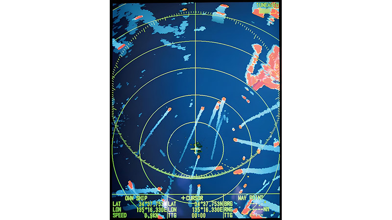
Integrating shipborne LiDAR with other maritime sensors enhances the overall accuracy and effectiveness of maritime operations. Combining data from multiple sources, such as sonar, radar, and satellite imagery, provides a more comprehensive view of the marine environment. Here’s how to effectively integrate LiDAR with other sensors:

1. Data Synchronization
- Time Stamping: Ensure all sensor data is accurately time-stamped to synchronize data from different sources. This alignment is crucial for combining data streams effectively.
- Coordinate Systems: Use a consistent coordinate system across all sensors to facilitate seamless integration and avoid misalignments in the final dataset.
- Data Interpolation: Employ interpolation techniques to fill in gaps between data points, ensuring a smooth transition between different sensor datasets.
2. Data Fusion Techniques
- Multi-Sensor Data Fusion: Combine LiDAR data with sonar, radar, and other sensor data to create a unified model of the marine environment. This approach enhances the accuracy of depth measurements, object detection, and environmental monitoring.
- Complementary Data Sources: Use LiDAR for above-water mapping and sonar for underwater features. Integrating these datasets provides a complete picture of both the surface and subsurface environments.
- Algorithm Selection: Choose appropriate algorithms for data fusion, such as Kalman filters or Bayesian networks, to ensure optimal integration and accurate results.
3. Real-Time Data Processing
- Onboard Processing: Equip vessels with onboard processing systems capable of handling real-time data from multiple sensors. This allows for immediate analysis and decision-making, critical for navigation and safety.
- Edge Computing: Implement edge computing to process data locally on the vessel, reducing latency and ensuring timely insights even in remote areas with limited connectivity.
- Data Streaming: Stream data from various sensors simultaneously for real-time fusion, allowing operators to monitor the environment continuously and make informed decisions quickly.
4. Visualization and Interpretation
- 3D Visualization: Create 3D models that integrate data from LiDAR, sonar, and radar. These models provide a comprehensive view of the maritime environment, aiding in navigation, planning, and safety assessments.
- Layered Mapping: Use layered maps to display different types of sensor data separately or in combination. This approach helps to identify specific features or anomalies more easily.
- Interactive Dashboards: Develop interactive dashboards that allow users to toggle between different sensor data, apply filters, and analyze specific areas of interest in real-time.
5. Data Management and Storage
- Centralized Data Repositories: Store all sensor data in a centralized repository to ensure easy access, management, and retrieval. Cloud-based solutions are ideal for this purpose, offering scalability and security.
- Data Compression: Use data compression techniques to manage the large volumes of data generated by multiple sensors without losing critical information.
- Long-Term Archiving: Implement archiving strategies for long-term storage of integrated datasets, ensuring that historical data is preserved for future analysis and reference.
Conclusion
Integrating shipborne LiDAR with other maritime sensors provides a more detailed and accurate understanding of the marine environment. By following best practices in data synchronization, fusion, real-time processing, visualization, and storage, maritime professionals can enhance their operational efficiency and safety. This multi-sensor approach is essential for meeting the complex challenges of modern maritime operations.


