Smart cities aim to optimize urban life through technology, and 3D LiDAR plays a pivotal role in this transformation. From traffic management to public safety, 3D LiDAR sensors are being integrated into smart city infrastructures to create safer, more efficient environments.
Urban Planning and Infrastructure Monitoring
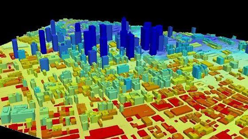
One of the main applications of 3D LiDAR in smart cities is urban planning. The technology allows city planners to create accurate, detailed 3D models of urban landscapes. These models are used for assessing infrastructure, planning new developments, and even monitoring the wear and tear of existing structures like bridges and roads.
Real-time data from 3D LiDAR sensors can detect changes or damage in infrastructure, helping to prevent accidents before they happen. For example, detecting small shifts in the foundation of a bridge early on can prompt timely repairs and avoid costly or dangerous failures.
Traffic Management and Safety
Traffic congestion is a growing problem in cities around the world. 3D LiDAR offers a solution by providing real-time data on traffic flow. Sensors positioned at intersections and along busy roads can monitor vehicle speeds, densities, and pedestrian movements. This data helps optimize traffic signals, reduce congestion, and enhance safety for both drivers and pedestrians.
In addition, 3D LiDAR can identify potential hazards in real-time, such as a pedestrian stepping into a crosswalk unexpectedly. The system can alert nearby autonomous vehicles or even trigger automated responses in smart traffic lights to prevent accidents.
Public Safety and Security
Public safety is another area where 3D LiDAR excels. The technology can be used in surveillance systems to monitor large crowds or public spaces without infringing on privacy, as it does not rely on cameras or facial recognition. LiDAR sensors can detect unusual behavior or movement patterns, allowing authorities to respond swiftly to potential security threats or emergencies.
Conclusion
3D LiDAR is helping smart cities become more efficient, safer, and sustainable. Whether it’s improving urban planning, managing traffic, or enhancing public safety, the precise, real-time data provided by 3D LiDAR is revolutionizing how cities operate. As the technology continues to evolve, its impact on urban environments will only grow.


