Urban planning is a complex process that requires accurate data and detailed modeling to create efficient, sustainable, and livable cities. 3D LiDAR technology has become a vital tool in this field, offering high-resolution spatial data that enhances planning and decision-making for urban development.
Creating Detailed City Models
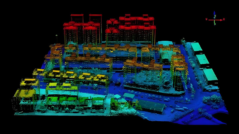
3D LiDAR allows urban planners to create detailed three-dimensional models of cityscapes. By capturing precise measurements of buildings, roads, and terrain, LiDAR provides a comprehensive view of urban areas. These models help planners visualize existing conditions and assess the impact of new developments or infrastructure projects.
For example, detailed city models generated from LiDAR data can be used to simulate the effects of proposed building projects on views, sunlight, and traffic flow. This enables planners to make informed decisions and design cities that are functional and aesthetically pleasing.
Enhancing Infrastructure Planning
In infrastructure planning, 3D LiDAR offers critical insights into the spatial relationships between different elements of the urban environment. LiDAR data can be used to analyze and plan transportation networks, utilities, and public spaces. This helps in optimizing the layout and connectivity of infrastructure, ensuring that new developments are well-integrated into the existing urban fabric.
LiDAR’s ability to provide accurate topographical data also aids in planning for flood risk management, drainage systems, and other environmental considerations. By understanding the terrain and elevation changes, planners can design infrastructure that minimizes environmental impact and improves resilience to natural hazards.
Supporting Sustainable Development
Sustainability is a key consideration in modern urban planning, and 3D LiDAR plays a role in supporting sustainable development practices. LiDAR data helps planners assess green spaces, analyze urban heat islands, and evaluate the impact of new developments on local ecosystems.
For instance, LiDAR can be used to measure tree canopy cover and assess the potential for urban greening initiatives. By integrating this data into planning processes, cities can promote environmental sustainability and enhance the quality of life for residents.
Facilitating Public Engagement
Effective urban planning requires input from the community, and 3D LiDAR data can facilitate public engagement by providing clear and interactive visualizations of planning proposals. 3D models and simulations created from LiDAR data can be used in public consultations and stakeholder meetings, allowing residents to better understand and provide feedback on proposed changes to their neighborhoods.
Conclusion
3D LiDAR is transforming urban planning by providing detailed, accurate, and comprehensive spatial data. From creating city models and enhancing infrastructure planning to supporting sustainable development and facilitating public engagement, LiDAR technology plays a crucial role in shaping the future of cities. As urban areas continue to grow and evolve, 3D LiDAR will remain an essential tool for creating well-planned, livable, and sustainable urban environments.


