Historical preservation is essential for safeguarding cultural heritage and maintaining the historical integrity of sites and structures. 3D LiDAR technology has become a powerful tool in this field, offering detailed spatial data that aids in documenting, preserving, and protecting historical assets.
Detailed Documentation of Historical Sites
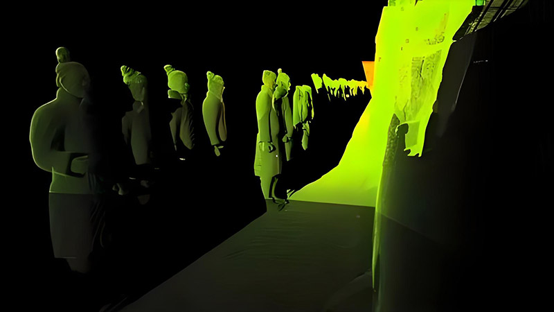
3D LiDAR provides precise and detailed documentation of historical sites and structures. By capturing high-resolution 3D data, LiDAR creates accurate digital records of architectural features, artwork, and landscapes. This documentation is invaluable for historical research, conservation planning, and public education.
For example, LiDAR can be used to document intricate architectural details of ancient buildings or archaeological sites. These detailed digital records help preserve the historical integrity of sites and provide a resource for future research and restoration efforts.
Enhancing Restoration and Conservation Efforts
In historical preservation, 3D LiDAR aids in restoration and conservation by providing detailed models of deteriorating or damaged structures. LiDAR data helps conservationists and restorers understand the current condition of historical assets, identify areas of deterioration, and plan appropriate restoration measures.
For instance, LiDAR can be used to assess the structural integrity of historic buildings and monuments. By analyzing the 3D models, restoration experts can develop accurate restoration plans and monitor the progress of conservation work.
Supporting Virtual Tours and Education
3D LiDAR technology also plays a role in enhancing public engagement and education through virtual tours and interactive experiences. Detailed 3D models of historical sites can be used to create virtual tours that allow people to explore and learn about cultural heritage from anywhere in the world.
Virtual tours and interactive exhibits provide educational opportunities and raise awareness about the significance of historical sites. They also offer a way to experience and appreciate cultural heritage without physical access, which is especially valuable for remote or restricted sites.
Monitoring and Managing Historical Sites
3D LiDAR contributes to the ongoing management and monitoring of historical sites. Regular LiDAR scans provide updated data on the condition of structures and landscapes, helping to detect changes or potential issues that may require attention. This proactive approach supports long-term preservation efforts and ensures that historical sites remain protected for future generations.
For example, LiDAR data can be used to monitor changes in the condition of ancient ruins or historic urban areas, allowing for timely interventions and maintenance.
Conclusion
3D LiDAR technology is revolutionizing historical preservation by providing detailed, accurate, and non-invasive methods for documenting, restoring, and protecting cultural heritage. From creating digital records and supporting conservation efforts to enhancing public education and monitoring sites, LiDAR plays a crucial role in preserving our shared history and ensuring that historical assets are safeguarded for future generations.


