Environmental monitoring relies on accurate and detailed data to track changes and manage natural resources effectively. 3D LiDAR technology has become a powerful tool in this field, offering high-resolution spatial data that enhances our ability to monitor and conserve ecosystems.
Detailed Mapping of Ecosystems
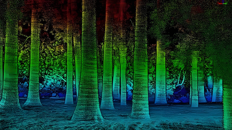
3D LiDAR provides detailed 3D maps of various ecosystems, including forests, wetlands, and coastal areas. By capturing precise measurements of vegetation height, canopy density, and terrain, LiDAR helps researchers create accurate models of these environments. This information is crucial for understanding ecological processes, assessing biodiversity, and evaluating the health of natural habitats.
For example, in forest management, 3D LiDAR can measure tree heights, canopy cover, and forest density, providing valuable insights into forest structure and biomass. This data aids in managing forest resources, planning conservation efforts, and monitoring changes due to logging or natural disturbances.
Monitoring Environmental Changes
One of the key applications of 3D LiDAR in environmental monitoring is tracking changes over time. LiDAR data can be used to create baseline models of landscapes, which can then be compared with subsequent scans to detect changes such as erosion, deforestation, or habitat degradation. This temporal analysis helps identify trends and assess the impact of human activities or natural events on the environment.
In coastal areas, 3D LiDAR can monitor shoreline changes, sea-level rise, and erosion. By comparing historical data with current scans, researchers can evaluate the effects of climate change and inform coastal management strategies.
Enhancing Conservation Efforts
Conservationists use 3D LiDAR to identify critical habitats, track wildlife populations, and assess the effectiveness of conservation measures. For instance, LiDAR can map the distribution of endangered plant species or analyze the impact of habitat fragmentation on wildlife corridors. This data supports targeted conservation efforts and helps prioritize areas for protection.
Moreover, 3D LiDAR assists in assessing the impact of conservation projects, such as reforestation or wetland restoration. By comparing pre- and post-project scans, conservationists can evaluate the success of their initiatives and make informed decisions for future projects.
Conclusion
3D LiDAR is transforming environmental monitoring by providing detailed, accurate spatial data that enhances our understanding of ecosystems and supports conservation efforts. From mapping ecosystems to tracking environmental changes and improving conservation strategies, LiDAR technology is a valuable tool for advancing environmental research and protecting natural resources.


